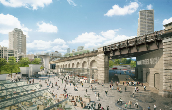
Today, 40 stakeholders released the Brooklyn Strand Community Vision Plan, a set of recommendations for developing almost 50 acres of public space that links the Brooklyn Bridge to Downtown Brooklyn. The plan focuses on broadening connectivity along the corridor by making the space more attractive and pedestrian-friendly, and improving access to the waterfront between the Navy Yard, DUMBO, and Downtown Brooklyn.

In 2014, Mayor de Blasio announced a set of plans to further catalyze the growth of downtown Brooklyn. One of these plans was the Brooklyn Strand, now a disjointed set of parks, greenways, and plazas bisected by highway feeder ramps that present wayfinding challenges even to seasoned New Yorkers. Since then, New York–based WXY Architecture + Urban Design has led not-for-profit local development corporation Downtown Brooklyn Partnership, Brooklyn Bridge Park, the Department of Parks and Recreation, the Department of Transportation, and over 250 community stakeholders through an intensive planning process to re-vision the Strand.
Recommendations from the just-released community vision include enhancing non-car links between Borough Hall Park, Columbus Park, Korean War Veterans Memorial Plaza, Cadman Plaza, Commodore Barry Park, the Bridge Parks, and Trinity Park; a “Gateway to Brooklyn” adjacent to Brooklyn Bridge Park with a viewing platform; creating a permanent market at Anchorage Plaza; reopening the long-shuttered Brooklyn War Memorial to the public; broadening access to Commodore Barry Park; widening sidewalks; installing public art to animate under-utilized public space; realign Brooklyn-Queens Expressway (BQE) ramps to make the pedestrian experience less alienating. https://archpaper.com/2016/05/wxy-designed-brooklyn-strand/
